Mesas mark the landscapes throughout New Mexico. These are created by erosion of softer rocks, while resistant rocks remain as prominent features.
In the eastern part of the county, along N.M. 6 and more prominently just north of the county where Interstate 25 cuts towards the Rio Grande at Isleta, the basalt-capped Black Mesa shows unmistakable black lava rocks capping softer light-colored sediments.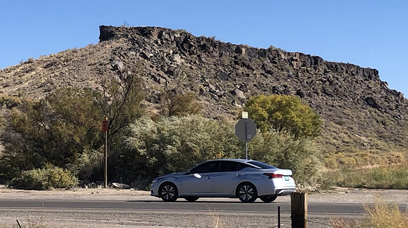
The basalt on top of these Black Mesa bluffs originated as lava that flowed about 3 million years ago. Like other liquids, the basalt would flow downhill and into low areas such as stream beds, valleys and canyons.
This presents a puzzle: How does lava flowing downhill end up on hilltops? Unless it defied gravity, the lava should have flowed to low areas, not on bluff tops. It did; the basalt that caps today’s bluffs was originally deposited in canyons and channels.
However, basalt is more resistant to erosion than the surrounding red sandstone and shale. Over time, erosion lowered the surrounding sediments faster than the basalt, leaving the basalt flows high and dry — creating this spectacular inverted topography.
The west mesa in Petroglyph National Monument in western Albuquerque is another example of inverted topography from lavas that erupted about 200,000 years ago.
(Paul Parmentier, a certified professional geologist retired from California and living in Los Lunas, shares the rich geologic features in Valencia County. He earned a Bachelor of Science degree in geology from Belgium and a master’s degree in geochemistry from Japan. The Geology Landscapes of Valencia County are featured monthly.)


